


Text Coming Soon!
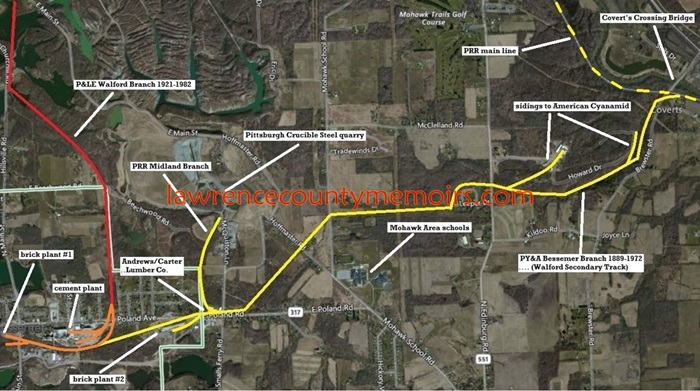 This map indicates the general routes of the railroads leading into Bessemer. The PY&A Bessemer Branch (shown in yellow), under the control of the PRR, opened in early 1889. It left the PY&A main line at Covert’s Crossing and extended about five miles to reach the developing industries at Bessemer. Several spurs were built off the branch in the coming years. The rival P&LE opened its road to Bessemer – known as the Walford Branch (shown in red) – in 1921. The orange lines indicate the area of the “Joint Territory,” trackage around the industries that was equally shared by the PRR and P&LE. (c2010) Full Size |
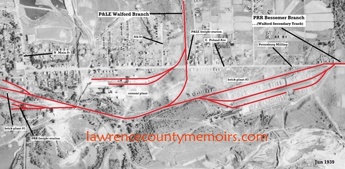
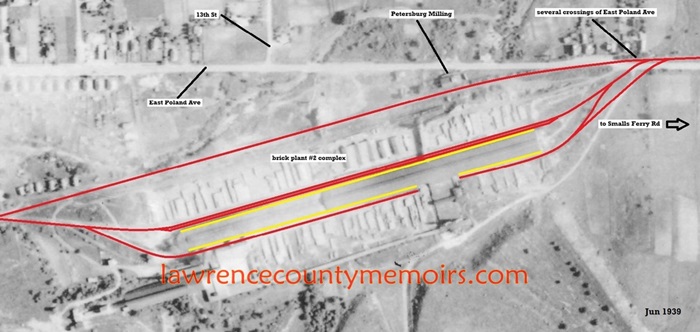 This map reveals how the PRR tracks generally crossed East Poland Avenue and entered into the area of brick plant #2. The lower tracks (next to the yellow lines) were recessed into the ground to allow for easier loading of bricks into the hopper cars. (1939) Full Size |
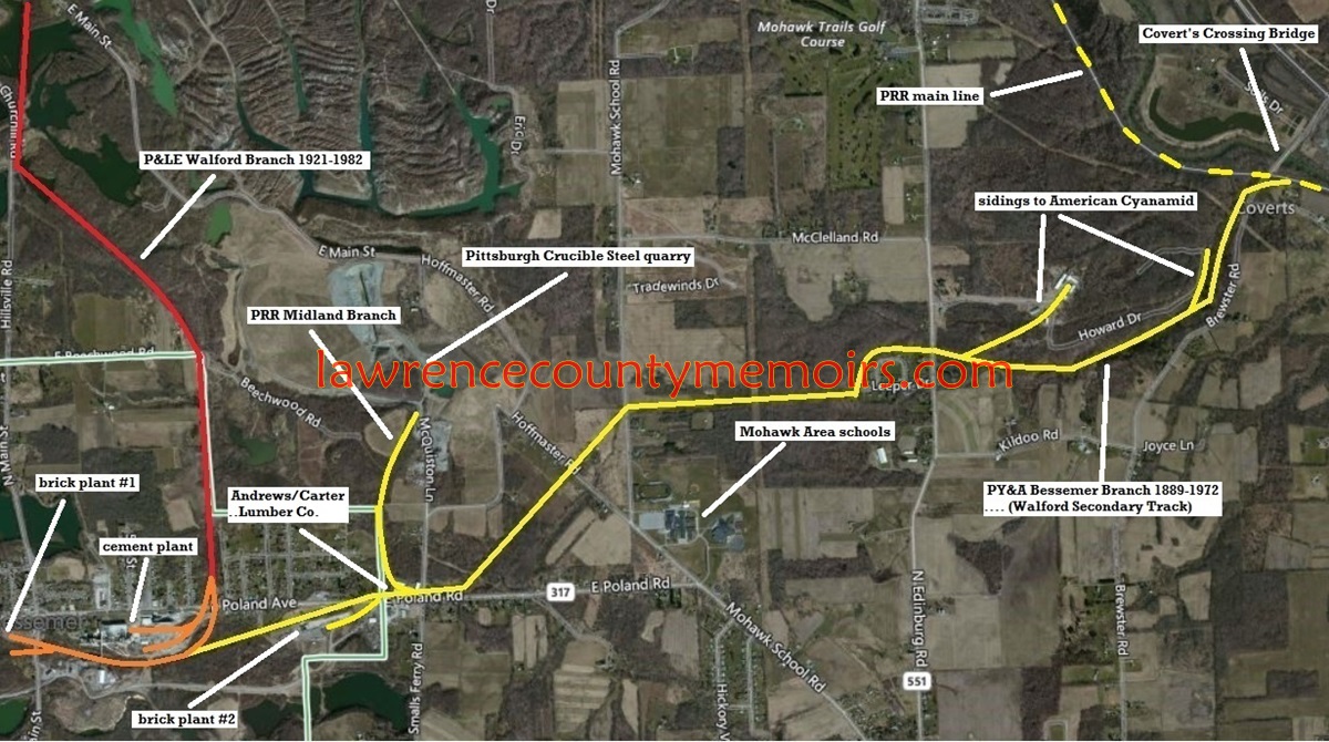
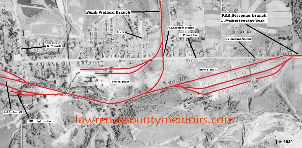
 This map reveals the general route of the “Joint Territory” shared by the PRR and the P&LE. It was an extremely busy area as a small standard gauge track controlled by Bessemer Limestone and several narrow gauge railways crisscrossed through the area as well. (1939) Full Size |
Comments
There are currently no comments on this article.
Comment