


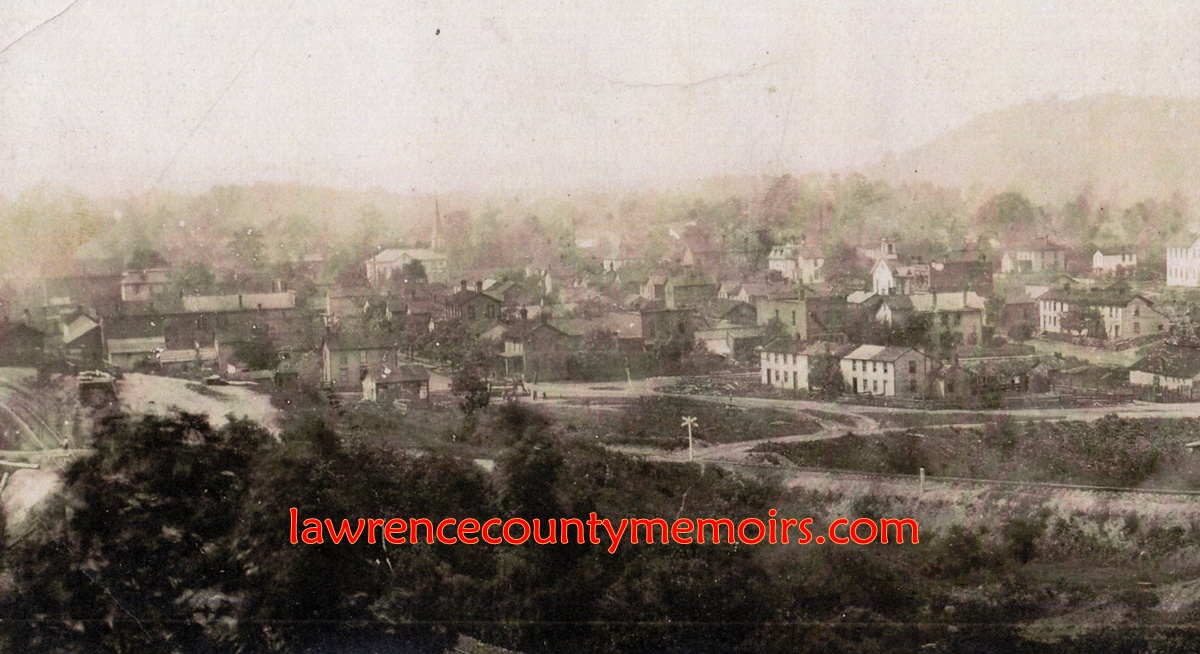
 This photo of Wampum is marked as “1890” but I wonder if its actually a little later – perhaps closer to 1900. In the foreground you can see the “high grade” and “low grade” railroad tracks coming together near Railroad Street (later J. F. Kennedy Street). In the central background you can make out the tall spire of the new Wampum Presbyterian Church. Scanning towards the right you can make out the Buchanan home, which is the current location of Marshall Funeral Home. You can also, although it’s very dark, see the IOOF building just below the Buchanan home. On the extreme right edge of this photo you can see the old schoolhouse (two-story white building) on Kay Street. The “church-like” building with the bell tower to the north (left) of the IOOF building is odd – it looks like a church? (Photo courtesy of Jim Strutz) (c1890) Full Size |
 Looking east towards Chewton and taken from what is now Rt. 18. You can see various mills in foreground on Beaver St, the old IOOF building in middle left on Main St, horse-drawn carriages going down Church St, and the roof sign of the Arlington Hotel in middle of right edge. Chewton would be off to the upper right side a bit. The Beaver River is obscured in this photo and runs behind the buildings on Main St – the white building in background is across the river and about where River Rd now sits. c1900-1905. |
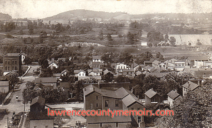
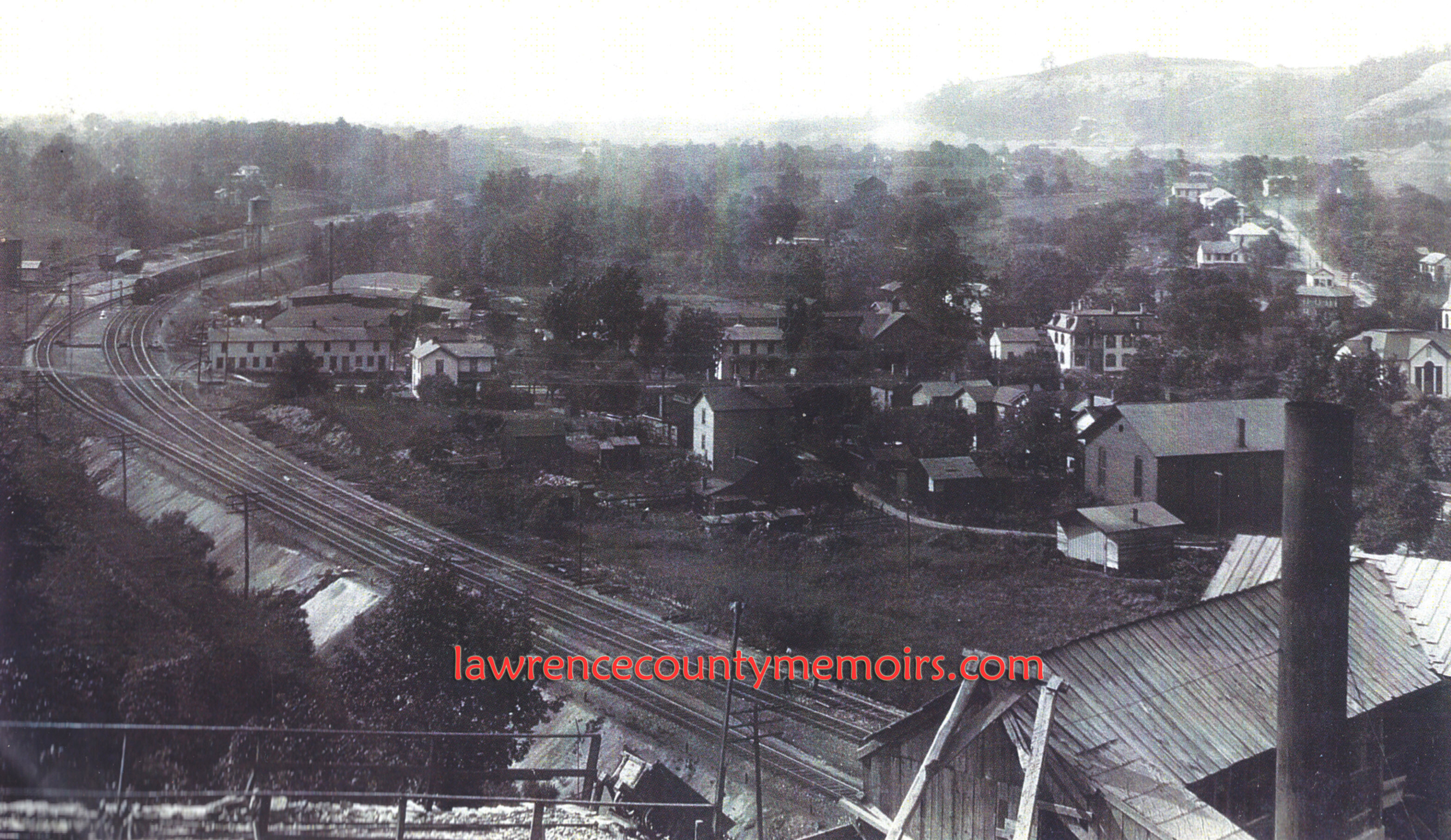
 Looking north over Wampum c1902. The railroad tracks leading north along the river on the right of this photo are of the Pennsylvania & Lake Erie Railroad (P&LE), served by the train station with the wrap around porch. A rail siding splits off and passes by the P&LE freight house – which still stands today. The Pennsylvania Railroad (PRR) or “Pennsy” tracks pass by in the foreground. The current Wampum Bridge into Lower Chewton is missing – as it would be constructed just beyond the P&LE train station in 1927. The old Wampum Bridge and old PRR railroad bridge are just off photo at the right bottom corner. What is now Main Street runs down the middle of this photo up to the Wampum Presbyterian Church (steeple is visible). Just to the left of the steeple you can see the many shops and mills along Beaver Street, which at the time of this photo was the principal commercial avenue of Wampum. |
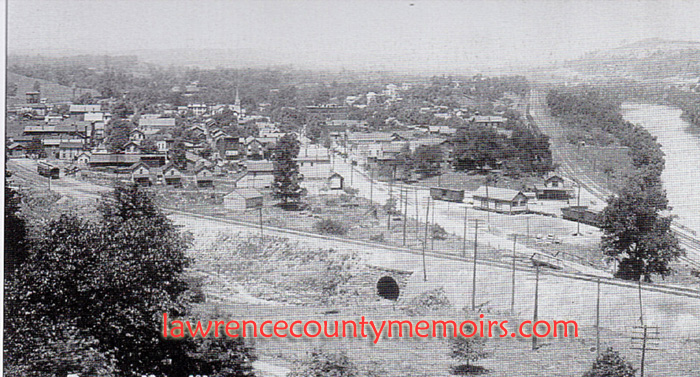
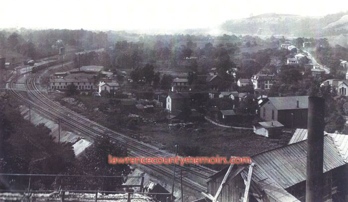 Overlooking the town of Wampum and the PRR railroad tracks. (c1908) Full Size |
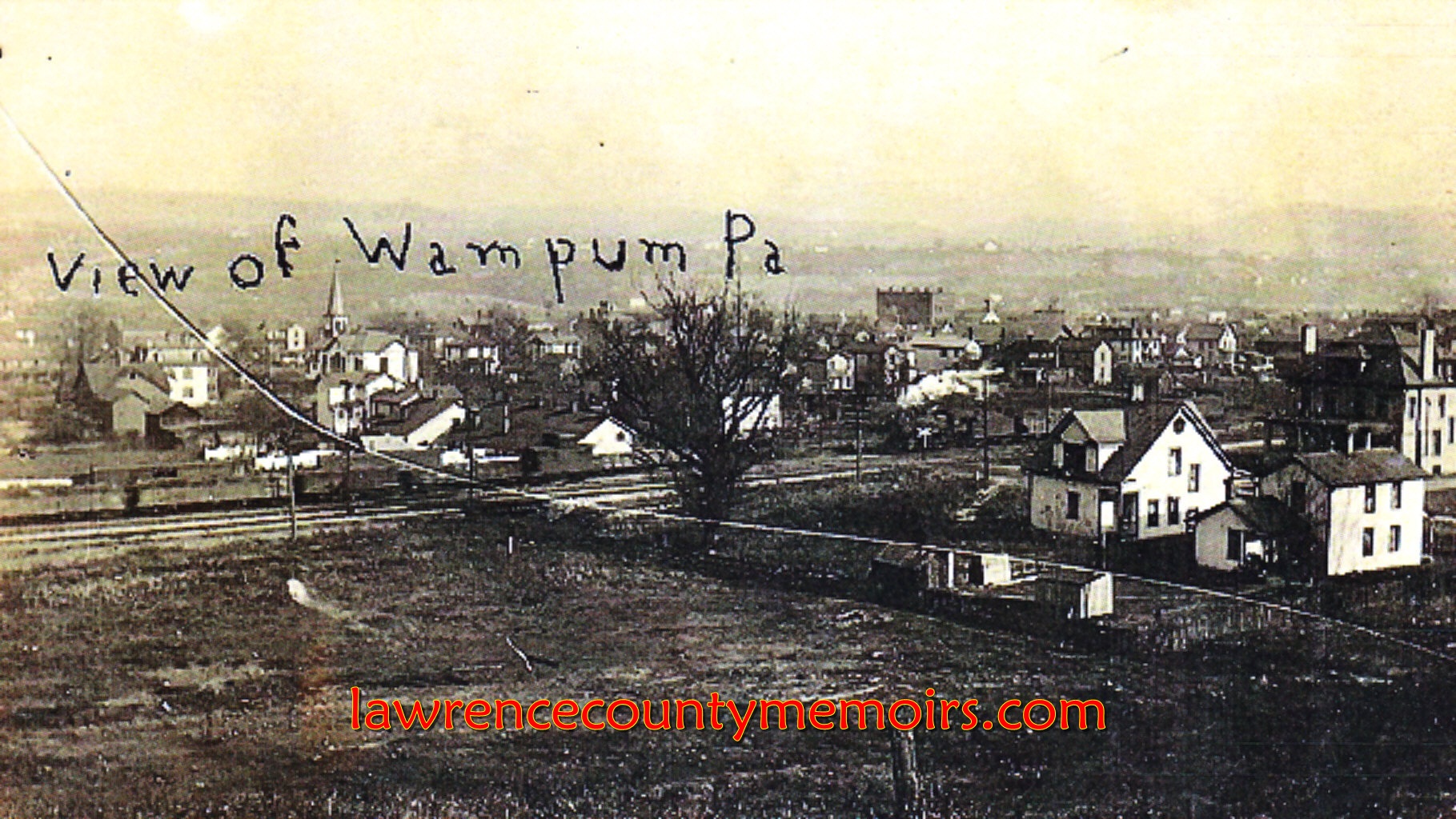
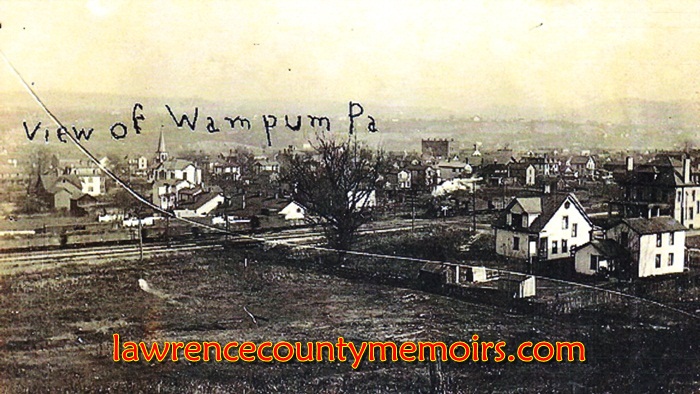 An old postcard of Wampum. I can make out the large Stapf house on Clyde Street (in middle of right edge), the Wampum Presbyterian Church under the “W” of Wampum, and the landmark IOOF building just to the right of “Pa.” (c1910) Full Size |
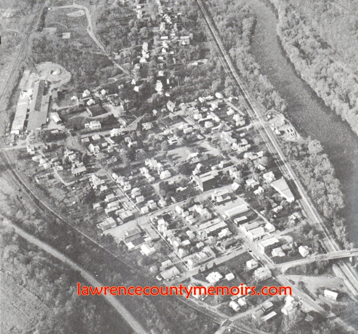 An aerial view of Wampum. (c1955) Full Size |
Comments
There are currently no comments on this article.
Comment